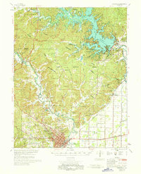
1968 Map of Poplar Bluff
USGS Topo · Published 1970About this map
The St Francis River and Black River valleys converge near the city of Poplar Bluff in this mid-century study of Butler and Wayne Counties. The landscape is defined by the massive Wappapello Reservoir to the north and a sophisticated network of drainage canals to the southeast, including Snyder Ditch and several numbered channels like Ditch No 2. These systems illustrate the era's intensive water management efforts to reclaim low-lying lands for development and agriculture.
Find a feature on this map
71 named features on this map. Tap any name to fly to it.
Don’t see what you’re looking for? This feature index may not catch every label — zoom into the map to look around manually.
Map Details
Editions of this 1968 Poplar Bluff Map
This is the sole edition of this map. No revisions or reprints were ever made.
Other maps of this area

1932 · Piedmont
USGS Topo · 1:62,500

1934 · Greenville
USGS Topo · 1:62,500

1934 · Williamsville
USGS Topo · 1:48,000

1934 · Puxico
USGS Topo · 1:62,500

1935 · Poplar Bluff
USGS Topo · 1:62,500

1935 · Zalma
USGS Topo · 1:62,500

1935 · Piedmont
USGS Topo · 1:62,500

1935 · Acorn
USGS Topo · 1:62,500

1935 · Harviell
USGS Topo · 1:62,500

1939 · Greenville
USGS Topo · 1:62,500