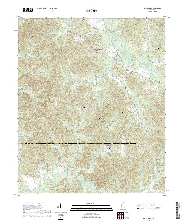
2024 Map of Poplar Creek
USGS Topo · Published 2024About this map
Poplar Creek serves as the central hub of this North Mississippi landscape, where the headwaters of numerous waterways like Armstrong Branch and Little Poplar Creek carve through the terrain. The area is defined by its deep genealogical roots, evidenced by a high density of family and community burial grounds including Old Pine Bluff Cem, Joe Walker Cem, and Adams Cem. To the south, the boundary between Montgomery Co and Attala Co cuts across a network of rural roads such as Ellis Rd and Walker Rd. The elevation rises distinctly at Arnold Mountain in the southern portion of the map, overlooking the winding path of Zilpha Creek. This modern survey preserves the locations of numerous historic sites, including two distinct locations for Old Friendship Cem, providing a detailed record of the settlement patterns and community foundations in this part of the state.
Find a feature on this map
67 named features on this map. Tap any name to fly to it.
Don’t see what you’re looking for? This feature index may not catch every label — zoom into the map to look around manually.
Map Details
Editions of this 2024 Poplar Creek Map
This is the sole edition of this map. No revisions or reprints were ever made.
Other maps of this area

1953 · West Point
USGS Topo · 1:250,000

1958 · West Point
USGS Topo · 1:250,000

1963 · West Point
USGS Topo · 1:250,000

1964 · Kosciusko NE
USGS Topo · 1:24,000

1964 · Hesterville
USGS Topo · 1:24,000

1966 · Kilmichael
USGS Topo · 1:24,000

1966 · Poplar Creek
USGS Topo · 1:24,000

1966 · Winona
USGS Topo · 1:24,000

1966 · Kosciusko
USGS Topo · 1:62,500

1966 · Stewart
USGS Topo · 1:24,000