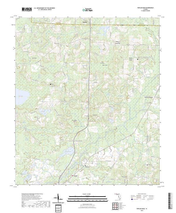
2024 Map of Poplar Head
USGS Topo · Published 2024About this map
Holmes Creek winds through the borderlands of Washington and Holmes counties, anchoring a landscape defined by expansive bays and wetland basins. The area’s settlement pattern is concentrated around several crossroads and rural clusters, including Poplar Head and Johnson Crossroad in the north and the outskirts of Vernon to the south. Significant for local genealogists, the map identifies several spiritual and burial sites such as the Pleasant Hill Freewill Baptist Church Cem and the Haddock Cem near the southern boundary.
Find a feature on this map
114 named features on this map. Tap any name to fly to it.
Don’t see what you’re looking for? This feature index may not catch every label — zoom into the map to look around manually.
Map Details
Editions of this 2024 Poplar Head Map
This is the sole edition of this map. No revisions or reprints were ever made.
Other maps of this area

1949 · Millers Ferry
USGS Topo · 1:24,000

1949 · Hinsons Cross Roads
USGS Topo · 1:24,000

1949 · Caryville
USGS Topo · 1:24,000

1950 · Millers Ferry
USGS Topo · 1:24,000

1950 · Hinsons Cross Roads
USGS Topo · 1:24,000

1950 · Caryville
USGS Topo · 1:24,000

1950 · Vernon
USGS Topo · 1:24,000

1950 · Chipley
USGS Topo · 1:24,000

1950 · Wausau
USGS Topo · 1:24,000

1950 · Gap Lake
USGS Topo · 1:24,000