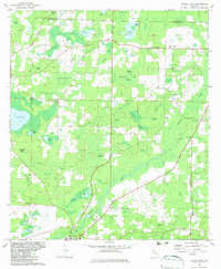
1982 Map of Poplar Head
USGS Topo · Published 1983About this map
Vernon serves as a central hub in this corner of the Florida panhandle, situated where Holmes Creek winds through the swampy landscape. The geography is defined by an intricate network of wetland features, including named bays and islands such as Clemmons Bay, Thompson Bay, and Roundabout Island. The drainage patterns are complex, with Cooks Mill Pond and Becton Branch feeding into the larger creek system. These natural features are interspersed with small upland ridges like Chalk Hill and Poplar Head Hill.
Find a feature on this map
56 named features on this map. Tap any name to fly to it.
Don’t see what you’re looking for? This feature index may not catch every label — zoom into the map to look around manually.
Map Details
Editions of this 1982 Poplar Head Map
This is the sole edition of this map. No revisions or reprints were ever made.
Other maps of this area

1949 · Millers Ferry
USGS Topo · 1:24,000

1949 · Hinsons Cross Roads
USGS Topo · 1:24,000

1949 · Caryville
USGS Topo · 1:24,000

1950 · Millers Ferry
USGS Topo · 1:24,000

1950 · Hinsons Cross Roads
USGS Topo · 1:24,000

1950 · Caryville
USGS Topo · 1:24,000

1950 · Vernon
USGS Topo · 1:24,000

1950 · Chipley
USGS Topo · 1:24,000

1950 · Wausau
USGS Topo · 1:24,000

1950 · Gap Lake
USGS Topo · 1:24,000