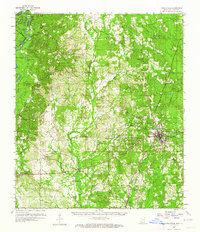
1959 Map of Poplarville
USGS Topo · Published 1964About this map
Poplarville serves as the focal point of this Mississippi landscape, home to the Pearl River Jr College and the junction of the Southern railroad. The topography is defined by the dense woodlands of the De Soto National Forest and the winding course of the Pearl River, which forms the boundary with Washington Parish. The rural character of the mid-20th century is preserved through a network of country schools and churches, including the White Sand Sch and Loyal Sch Ch.
Find a feature on this map
54 named features on this map. Tap any name to fly to it.
Don’t see what you’re looking for? This feature index may not catch every label — zoom into the map to look around manually.
Map Details
Editions of this 1959 Poplarville Map
3 editions found

Other maps of this area

1942 · Pools Bluff
USGS Topo · 1:31,680

1949 · Bogalusa East
USGS Topo · 1:31,680

1949 · Angie
USGS Topo · 1:31,680

1953 · Hattiesburg
USGS Topo · 1:250,000

1953 · Mobile
USGS Topo · 1:250,000

1955 · Savannah
USGS Topo · 1:62,500

1957 · Mobile
USGS Topo · 1:250,000

1958 · Hattiesburg
USGS Topo · 1:250,000

1958 · Carnes
USGS Topo · 1:62,500

1958 · Picayune
USGS Topo · 1:62,500