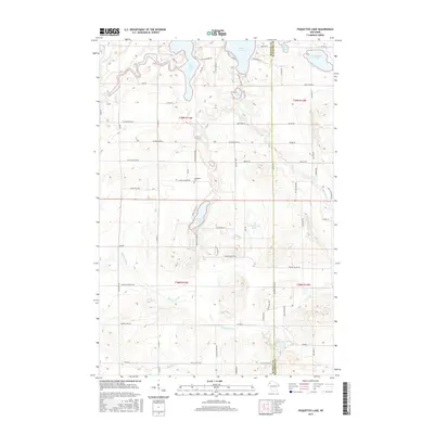
2015 Map of Poquettes Lake
USGS Topo · Published 2015About this map
Poquettes Lake sits at the heart of this glacial landscape on the border of Burnett and Washburn counties. The terrain is defined by a dense network of water bodies, including Rice Lake, Lipsett Lake, and Glendenning Lake, which are linked by smaller tributaries like Bashaw Brook and Montgomery Cr. The presence of Indian Mounds Rd in the north indicates the region's ancient archaeological significance, while the Greendale Cem provides a focal point for local genealogical research. The Yellow River meanders through the central and northern sections, carving a path through the low-lying wetlands. This 2015 survey reflects a rural landscape shaped by post-glacial topography, where the distribution of roads like Swiss Chalet Rd and Bashaw Lake Rd follows the natural contours of the lakes and springs, such as Bashaw Trout Springs.
Find a feature on this map
44 named features on this map. Tap any name to fly to it.
Don’t see what you’re looking for? This feature index may not catch every label — zoom into the map to look around manually.
Map Details
Editions of this 2015 Poquettes Lake Map
This is the sole edition of this map. No revisions or reprints were ever made.
Other maps of this area

1948 · Spooner
USGS Topo · 1:48,000

1949 · Hertel
USGS Topo · 1:48,000

1949 · Spooner
USGS Topo · 1:48,000

1951 · Cumberland
USGS Topo · 1:48,000

1951 · Shell Lake
USGS Topo · 1:48,000

1953 · Rice Lake
USGS Topo · 1:250,000

1953 · Stillwater
USGS Topo · 1:250,000

1955 · Hertel
USGS Topo · 1:62,500

1955 · Stillwater
USGS Topo · 1:250,000

1956 · Cumberland
USGS Topo · 1:62,500