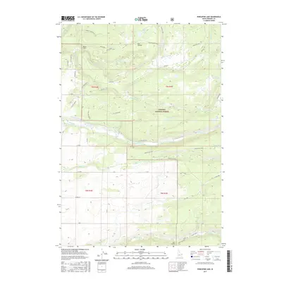
2017 Map of Porcupine Lake
USGS Topo · Published 2017About this map
Targhee National Forest dominates this section of eastern Idaho, where the high country transitions from timbered ridges into a complex network of agricultural irrigation. The Fall River serves as a primary hydrological artery, supporting man-made infrastructure like the Yellowstone Canal, Marysville Canal, and the Yellowstone Ditch. These waterways represent the vital intersection of the region's natural river systems and its mid-20th-century ranching development.
Find a feature on this map
58 named features on this map. Tap any name to fly to it.
Don’t see what you’re looking for? This feature index may not catch every label — zoom into the map to look around manually.
Map Details
Editions of this 2017 Porcupine Lake Map
This is the sole edition of this map. No revisions or reprints were ever made.
Other maps of this area

1955 · Ashton
USGS Topo · 1:250,000

1955 · Driggs
USGS Topo · 1:250,000

1957 · Warm River Butte
USGS Topo · 1:62,500

1958 · Driggs
USGS Topo · 1:250,000

1958 · Ashton
USGS Topo · 1:250,000

1960 · Ashton
USGS Topo · 1:250,000

1962 · Driggs
USGS Topo · 1:250,000

1965 · Lamont
USGS Topo · 1:24,000

1965 · Mc Renolds Reservoir
USGS Topo · 1:24,000

1965 · Snake River Butte
USGS Topo · 1:24,000