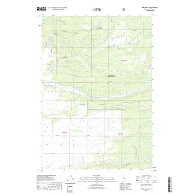
2020 Map of Porcupine Lake
USGS Topo · Published 2020About this map
The Targhee National Forest dominates this section of Fremont County, where the high-elevation landscape is defined by the canyon-forming waters of the Fall River and its numerous tributaries. Significant hydrological management for the region is evident through the presence of the Marysville Canal and Yellowstone Canal, which divert water from the river system to support agriculture further downstream. Local landmarks like Porcupine GS and the dramatic Cave Falls mark this area of the forest.
Find a feature on this map
51 named features on this map. Tap any name to fly to it.
Don’t see what you’re looking for? This feature index may not catch every label — zoom into the map to look around manually.
Map Details
Editions of this 2020 Porcupine Lake Map
This is the sole edition of this map. No revisions or reprints were ever made.
Other maps of this area

1955 · Ashton
USGS Topo · 1:250,000

1955 · Driggs
USGS Topo · 1:250,000

1957 · Warm River Butte
USGS Topo · 1:62,500

1958 · Driggs
USGS Topo · 1:250,000

1958 · Ashton
USGS Topo · 1:250,000

1960 · Ashton
USGS Topo · 1:250,000

1962 · Driggs
USGS Topo · 1:250,000

1965 · Lamont
USGS Topo · 1:24,000

1965 · Mc Renolds Reservoir
USGS Topo · 1:24,000

1965 · Snake River Butte
USGS Topo · 1:24,000