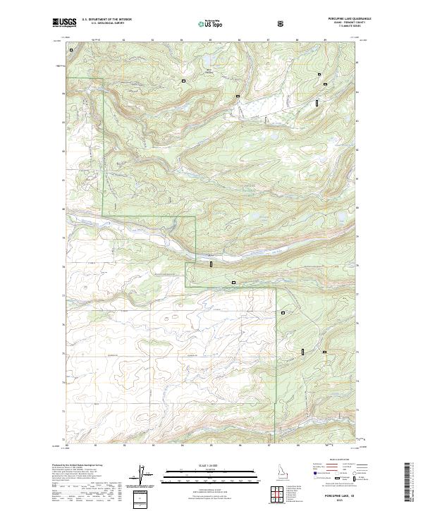
2023 Map of Porcupine Lake
USGS Topo · Published 2023About this map
Fall River and its accompanying irrigation works define the southern reaches of this landscape, where the Yellowstone Canal and Marysville Canal cut through the terrain to support regional agriculture. This area within the Targhee National Forest transitions from water-rich meadows like Bear Meadow to the sharp elevation changes of the Robinson Creek Breaks. The geography is shaped by a dense network of drainages, including Robinson Creek, Squirrel Creek, and Conant Creek, which flow through various draws and hollows. Transport in this part of Fremont County relies on established corridors like the Ashton-Flagg Ranch Rd and Falls River Ridge Rd, providing access to remote points such as Cave Falls and the secluded Porcupine Lake. The map illustrates the sophisticated water management systems required to navigate the high-country hydrology near the Idaho-Wyoming border.
Find a feature on this map
52 named features on this map. Tap any name to fly to it.
Don’t see what you’re looking for? This feature index may not catch every label — zoom into the map to look around manually.
Map Details
Editions of this 2023 Porcupine Lake Map
This is the sole edition of this map. No revisions or reprints were ever made.
Other maps of this area

1955 · Ashton
USGS Topo · 1:250,000

1955 · Driggs
USGS Topo · 1:250,000

1957 · Warm River Butte
USGS Topo · 1:62,500

1958 · Driggs
USGS Topo · 1:250,000

1958 · Ashton
USGS Topo · 1:250,000

1960 · Ashton
USGS Topo · 1:250,000

1962 · Driggs
USGS Topo · 1:250,000

1965 · Lamont
USGS Topo · 1:24,000

1965 · Mc Renolds Reservoir
USGS Topo · 1:24,000

1965 · Snake River Butte
USGS Topo · 1:24,000