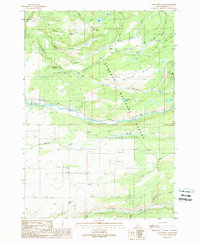
1989 Map of Porcupine Lake
USGS Topo · Published 1989About this map
Targhee National Forest dominates this high-country landscape, where the Falls River carves a path through the southern reaches of the Targhee Ridge. In the late 1980s, this area functioned as a vital water management corridor, evidenced by the Marysville Canal and Yellowstone Canal running parallel to the river. The presence of a Gaging Sta near the western edge underscores the importance of monitoring these mountain flows for downstream irrigation and use.
Find a feature on this map
31 named features on this map. Tap any name to fly to it.
Don’t see what you’re looking for? This feature index may not catch every label — zoom into the map to look around manually.
Map Details
Editions of this 1989 Porcupine Lake Map
This is the sole edition of this map. No revisions or reprints were ever made.
Other maps of this area

1955 · Ashton
USGS Topo · 1:250,000

1955 · Driggs
USGS Topo · 1:250,000

1957 · Warm River Butte
USGS Topo · 1:62,500

1958 · Driggs
USGS Topo · 1:250,000

1958 · Ashton
USGS Topo · 1:250,000

1960 · Ashton
USGS Topo · 1:250,000

1962 · Driggs
USGS Topo · 1:250,000

1965 · Lamont
USGS Topo · 1:24,000

1965 · Mc Renolds Reservoir
USGS Topo · 1:24,000

1965 · Snake River Butte
USGS Topo · 1:24,000