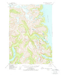
1951 Map of Port Alexander D-3
USGS Topo · Published 1962About this map
Baranof Island is defined by its dramatic glacial topography and deep marine inlets in this early 1950s survey. The landscape is dominated by steep-walled ridges and high peaks, including Mt Radamaker, Mt Race, and Mount Harding, which rise abruptly from the waters of Chatham Strait. The interior is marked by a complex system of interconnected water bodies such as Benzeman Lake and the Vodopad River, which flow through the wilderness of the Tongass National Forest.
Find a feature on this map
18 named features on this map. Tap any name to fly to it.
Don’t see what you’re looking for? This feature index may not catch every label — zoom into the map to look around manually.
Map Details
Editions of this 1951 Port Alexander D-3 Map
3 editions found
Other maps of this area

1948 · Sitka A-3
USGS Topo · 1:63,360

1948 · Sitka A-2
USGS Topo · 1:63,360

1951 · Sitka
USGS Topo · 1:250,000

1951 · Port Alexander C-4
USGS Topo · 1:63,360

1951 · Port Alexander D-4
USGS Topo · 1:63,360

1951 · Port Alexander C-2
USGS Topo · 1:63,360

1951 · Port Alexander C-3
USGS Topo · 1:63,360

1951 · Port Alexander D-3
USGS Topo · 1:63,360

1951 · Port Alexander
USGS Topo · 1:250,000

1951 · Port Alexander D-2
USGS Topo · 1:63,360