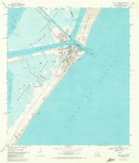
1968 Map of Port Aransas
USGS Topo · Published 1972About this map
Port Aransas sits at the northern tip of Mustang Island, serving as a focal point for maritime activity where the Corpus Christi Channel meets the Gulf of Mexico during the late 1960s. The landscape is defined by its strategic position between Harbor Island and St Joseph Island, connected by the deep-water Aransas Pass. Local landmarks like the Aransas Pass Lighthouse and the Univ of Texas Marine Science Institute highlight the area's dual role as a navigational waypoint and a center for coastal study. Along the shoreline, the Mustang Beach Landing Strip and the Horace Caldwell Pier suggest a growing mid-century recreation and aviation presence. Further south on the island, the Royal Palm Cem and small developments at Mustang Beach and Holiday Beach provide valuable location data for genealogists tracking family ties to these barrier island communities.
Find a feature on this map
30 named features on this map. Tap any name to fly to it.
Don’t see what you’re looking for? This feature index may not catch every label — zoom into the map to look around manually.
Map Details
Editions of this 1968 Port Aransas Map
2 editions found
Other maps of this area

1925 · Aransas Pass
USGS Topo · 1:62,500

1950 · Corpus Christi
USGS Topo · 1:250,000

1951 · Crane Islands NW
USGS Topo · 1:24,000

1951 · Allyns Bight
USGS Topo · 1:24,000

1951 · Crane Islands
USGS Topo · 1:62,500

1954 · Aransas Pass
USGS Topo · 1:24,000

1954 · Port Ingleside
USGS Topo · 1:24,000

1954 · Estes
USGS Topo · 1:24,000
1954 · Port Aransas
USGS Topo · 1:24,000

1954 · Aransas Pass
USGS Topo · 1:62,500