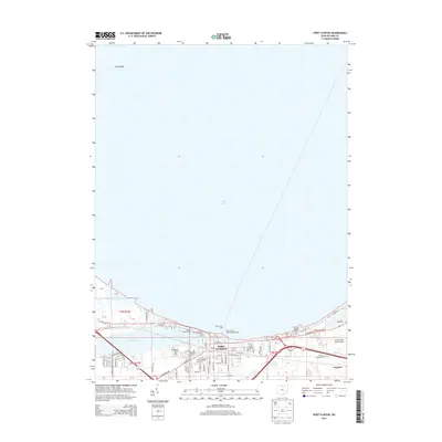
2013 Map of Port Clinton
USGS Topo · Published 2013About this map
Port Clinton sits at the critical junction where the Portage River meets Lake Erie, serving as a focal point for maritime activity and commerce in northern Ohio. The 2013 landscape shows a well-developed waterfront defined by several specialized basins, including the Clinton Reef Marina and Brands Marina. To the east, the settlement of Gypsum and the nearby Carl R Keller Field Airport represent the industrial and transit infrastructure of Ottawa County. Local history is deeply rooted along the shoreline, marked by several significant burial grounds including Riverview Cem and Shook Cem. Navigational landmarks like the Port Clinton Light and the Port Clinton East Pierhead Light underscore the area's ongoing importance as a harbor. The street grid of the city, featuring names like E Perry St and Washington St, leads directly to community hubs such as Tru-Lay Stadium.
Find a feature on this map
64 named features on this map. Tap any name to fly to it.
Don’t see what you’re looking for? This feature index may not catch every label — zoom into the map to look around manually.
Map Details
Editions of this 2013 Port Clinton Map
This is the sole edition of this map. No revisions or reprints were ever made.
Other maps of this area

1900 · Oak Harbor
USGS Topo · 1:62,500

1901 · Put-In-Bay
USGS Topo · 1:62,500

1901 · Bellevue
USGS Topo · 1:62,500

1901 · Fremont
USGS Topo · 1:62,500

1903 · Bellevue
USGS Topo · 1:62,500

1903 · Fremont
USGS Topo · 1:62,500

1903 · Put In Bay
USGS Topo · 1:62,500

1952 · Lacarne
USGS Topo · 1:24,000

1952 · Oak Harbor
USGS Topo · 1:62,500

1956 · Toledo
USGS Topo · 1:250,000
Featured Places
- Port Clinton, OH
- Put-in-Bay Township, OH
- Catawba Island Township, OH
- Erie Township, OH
- Portage Township, OH