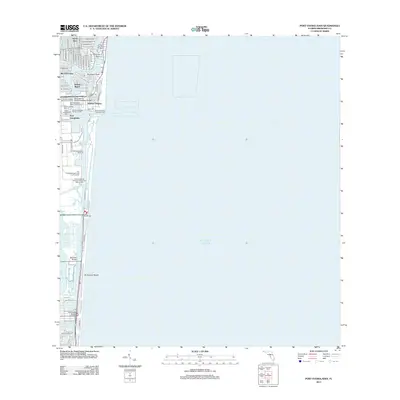
2012 Map of Port Everglades
USGS Topo · Published 2012About this map
Port Everglades dominates this 2012 coastal survey, showcasing the sophisticated maritime infrastructure of south Florida. The industrial deep-water berths, including the Turning Basin and Port Everglades Approach Light, sit in direct contrast to the intricate residential finger islands like Nurmi Isles, Rio Vista Isles, and Harbor Beach. This pattern of dredged canals and artificial islands defines the local geography, where waterways like the Stranahan River and New River Sound serve both as navigational channels and neighborhood borders.
Find a feature on this map
63 named features on this map. Tap any name to fly to it.
Don’t see what you’re looking for? This feature index may not catch every label — zoom into the map to look around manually.
Map Details
Editions of this 2012 Port Everglades Map
This is the sole edition of this map. No revisions or reprints were ever made.
Other maps of this area

1945 · Fort Lauderdale North
USGS Topo · 1:24,000

1947 · North Miami
USGS Topo · 1:24,000

1949 · Fort Lauderdale North
USGS Topo · 1:24,000

1949 · Port Everglades
USGS Topo · 1:24,000

1949 · Fort Lauderdale South
USGS Topo · 1:24,000

1949 · Pompano Beach
USGS Topo · 1:24,000

1950 · North Miami
USGS Topo · 1:24,000

1956 · Miami
USGS Topo · 1:250,000

1956 · West Palm Beach
USGS Topo · 1:250,000

1957 · West Palm Beach
USGS Topo · 1:250,000
Featured Places
- Fort Lauderdale, FL
- Harbor Heights, Fort Lauderdale
- Nurmi Isles, Fort Lauderdale
- Harbor Beach, Fort Lauderdale
- Rio Vista Isles, Fort Lauderdale