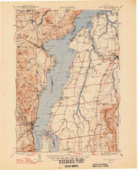
1947 Map of Port Henry
USGS Topo · Published 1947About this map
Lake Champlain dominates the center of this post-war landscape, serving as the border between New York's Essex County and Vermont's Addison County. On the New York shore, the industrial and transport history of Port Henry and Westport is evident, connected by the Delaware and Hudson RR and proximity to mining sites like Ore Bed Pt. The southern narrows are guarded by military history at Fort St Frederic Ruins and Fort Amherst Ruins, located near the Lake Champlain Orchard Pt Toll Bridge. To the east in Vermont, the terrain transitions into a dense network of rural infrastructure supporting communities like Vergennes and Addison. This side of the lake is particularly rich in local genealogy markers, featuring numerous schools such as Vanderhoof Sch and Nortontown Sch, alongside many family and community burial grounds including Gage Cem and Webster Cem.
Find a feature on this map
163 named features on this map. Tap any name to fly to it.
Don’t see what you’re looking for? This feature index may not catch every label — zoom into the map to look around manually.
Map Details
Editions of this 1947 Port Henry Map
2 editions found
Other maps of this area

1894 · Elizabethtown
USGS Topo · 1:62,500

1894 · Port Henry
USGS Topo · 1:62,500

1894 · Ticonderoga
USGS Topo · 1:62,500

1895 · Willsboro
USGS Topo · 1:62,500

1895 · Elizabethtown
USGS Topo · 1:62,500

1895 · Ausable
USGS Topo · 1:62,500

1895 · Paradox Lake
USGS Topo · 1:62,500

1896 · Ticonderoga
USGS Topo · 1:62,500

1897 · Paradox Lake
USGS Topo · 1:62,500

1898 · Port Henry
USGS Topo · 1:62,500