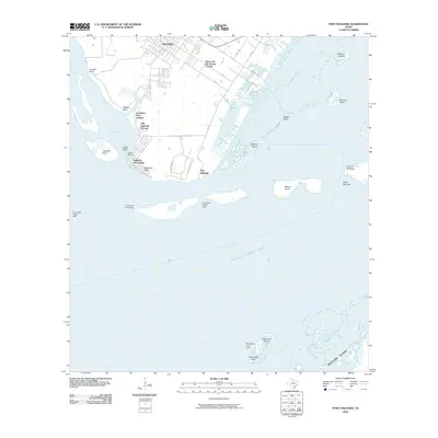
2010 Map of Port Ingleside
USGS Topo · Published 2010About this map
Port Ingleside and its surrounding coastal settlements dominate the shoreline north of Corpus Christi Bay in this 2010 survey. The landscape is characterized by a series of residential colonias and waterfront developments, including Old Ingleside Colonia, Caruthers Cove Colonia, and the established community of Ingleside On-the-Bay. Navigation is central to this stretch of the Texas coast, marked by features such as the Bahia Marina and several range lights like the Cut B East Range Light that guide vessels through the intracoastal waters.
Find a feature on this map
42 named features on this map. Tap any name to fly to it.
Don’t see what you’re looking for? This feature index may not catch every label — zoom into the map to look around manually.
Map Details
Editions of this 2010 Port Ingleside Map
This is the sole edition of this map. No revisions or reprints were ever made.
Other maps of this area

1925 · Aransas Pass
USGS Topo · 1:62,500

1925 · Oso Creek
USGS Topo · 1:62,500

1925 · Corpus Christi
USGS Topo · 1:62,500

1950 · Corpus Christi
USGS Topo · 1:250,000

1951 · Portland
USGS Topo · 1:24,000

1951 · Corpus Christi
USGS Topo · 1:62,500

1951 · Crane Islands NW
USGS Topo · 1:24,000

1951 · Oso Creek NE
USGS Topo · 1:24,000

1951 · Oso Creek
USGS Topo · 1:62,500

1951 · Crane Islands
USGS Topo · 1:62,500