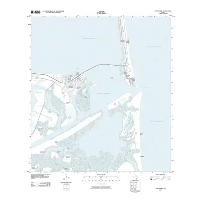
2010 Map of Port Isabel
USGS Topo · Published 2010About this map
Port Isabel serves as the focal point for this coastal survey, where the mainland meets the vast Laguna Madre. The landscape is defined by the heavy maritime and tourism infrastructure connecting the city to South Padre Island via the Queen Isabella Causeway. Notable landmarks such as the Point Isabel Lighthouse stand near several specialized waterfront developments, including Anchor Marina and Southpoint Marina, illustrating the area's deep-rooted reliance on the Gulf's waters.
Find a feature on this map
39 named features on this map. Tap any name to fly to it.
Don’t see what you’re looking for? This feature index may not catch every label — zoom into the map to look around manually.
Map Details
Editions of this 2010 Port Isabel Map
This is the sole edition of this map. No revisions or reprints were ever made.
Other maps of this area

1929 · La Coma
USGS Topo · 1:24,000

1929 · Palmito Hill
USGS Topo · 1:24,000

1929 · Point Isabel
USGS Topo · 1:24,000

1929 · Laguna Vista
USGS Topo · 1:24,000

1930 · Padre Island No. 1
USGS Topo · 1:24,000

1934 · Port Isabel
USGS Topo · 1:31,680

1934 · La Coma
USGS Topo · 1:31,680

1935 · Padre Island No 1
USGS Topo · 1:31,680

1936 · Palmito Hill
USGS Topo · 1:31,680

1936 · Laguna Vista
USGS Topo · 1:31,680