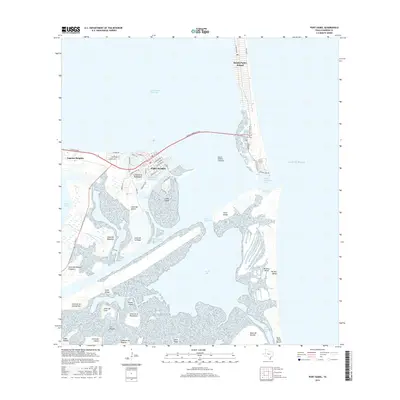
2016 Map of Port Isabel
USGS Topo · Published 2016About this map
Port Isabel stands at the maritime crossroads of the lower Texas coast, where the Brownsville Ship Channel meets the Intracoastal Waterway. This coastal landscape is defined by its series of lomas—unique clay dunes such as Loma del Mesquite and Loma de la Palangana—rising above the tidal flats of South Bay. The massive Queen Isabella Causeway serves as the primary artery connecting the mainland to the southern tip of South Padre Island, bridging the waters of the Laguna Madre system. To the south, the terrain becomes increasingly complex with the wetlands of Boca Chica Bay and the shoreline of Del Mar Beach, leading toward the mouth of the Rio Grande. The map captures the significant industrial and navigational infrastructure required for deep-water access, including the Port Isabel Channel and the protection afforded by Long Island, set against the delicate environmental transition of the Gulf Of Mexico coast.
Find a feature on this map
61 named features on this map. Tap any name to fly to it.
Don’t see what you’re looking for? This feature index may not catch every label — zoom into the map to look around manually.
Map Details
Editions of this 2016 Port Isabel Map
This is the sole edition of this map. No revisions or reprints were ever made.
Other maps of this area

1929 · La Coma
USGS Topo · 1:24,000

1929 · Palmito Hill
USGS Topo · 1:24,000

1929 · Point Isabel
USGS Topo · 1:24,000

1929 · Laguna Vista
USGS Topo · 1:24,000

1930 · Padre Island No. 1
USGS Topo · 1:24,000

1934 · Port Isabel
USGS Topo · 1:31,680

1934 · La Coma
USGS Topo · 1:31,680

1935 · Padre Island No 1
USGS Topo · 1:31,680

1936 · Palmito Hill
USGS Topo · 1:31,680

1936 · Laguna Vista
USGS Topo · 1:31,680