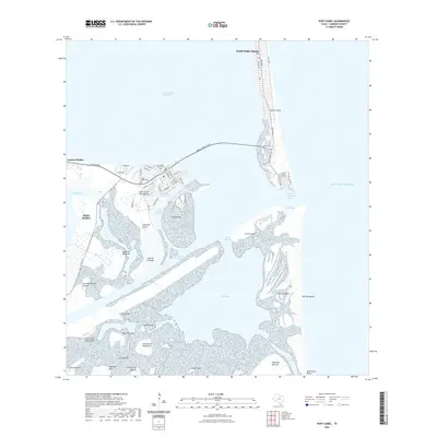
2022 Map of Port Isabel
USGS Topo · Published 2022About this map
Port Isabel serves as the focal point of this coastal survey, where the mainland meets the vast Laguna Madre and the Gulf of Mexico. The town's layout is defined by its relationship to the sea, featuring the Port Isabel Channel and the Port Isabel Side Channel which facilitate maritime industry. To the west, Laguna Heights overlooks the wetlands of Vadia Ancha, while the Queen Isabella Causeway provides a critical link across the water to the southern tip of Padre Island.
Find a feature on this map
67 named features on this map. Tap any name to fly to it.
Don’t see what you’re looking for? This feature index may not catch every label — zoom into the map to look around manually.
Map Details
Editions of this 2022 Port Isabel Map
This is the sole edition of this map. No revisions or reprints were ever made.
Other maps of this area

1929 · La Coma
USGS Topo · 1:24,000

1929 · Palmito Hill
USGS Topo · 1:24,000

1929 · Point Isabel
USGS Topo · 1:24,000

1929 · Laguna Vista
USGS Topo · 1:24,000

1930 · Padre Island No. 1
USGS Topo · 1:24,000

1934 · Port Isabel
USGS Topo · 1:31,680

1934 · La Coma
USGS Topo · 1:31,680

1935 · Padre Island No 1
USGS Topo · 1:31,680

1936 · Palmito Hill
USGS Topo · 1:31,680

1936 · Laguna Vista
USGS Topo · 1:31,680