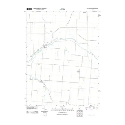
2010 Map of Port Jefferson
USGS Topo · Published 2010About this map
The Great Miami River winds through Shelby County, defining the settlement patterns of this agrarian region. Along its banks, Port Jefferson and Pasco serve as historic focal points, connected by a network of rural roads such as Pasco Montra Rd and Dingman Slagle Rd. The map reveals a dense concentration of burial grounds that offer significant value for genealogical research, including the Pioneer Cemetery near the river and the Old Dunkard Cemetery further south. These sites, along with others like Cedar Point Cemetery and Glen Cemetery, reflect the generational stability of the local communities.
Find a feature on this map
58 named features on this map. Tap any name to fly to it.
Don’t see what you’re looking for? This feature index may not catch every label — zoom into the map to look around manually.
Map Details
Editions of this 2010 Port Jefferson Map
This is the sole edition of this map. No revisions or reprints were ever made.
Other maps of this area

1913 · Bellefontaine
USGS Topo · 1:48,000

1913 · Sidney
USGS Topo · 1:62,500

1914 · Troy
USGS Topo · 1:62,500

1914 · St. Paris
USGS Topo · 1:62,500

1915 · Bellefontaine
USGS Topo · 1:62,500

1916 · St. Paris
USGS Topo · 1:62,500

1944 · Sidney
USGS Topo · 1:62,500

1944 · St. Paris
USGS Topo · 1:62,500

1944 · Troy
USGS Topo · 1:62,500

1944 · Bellefontaine
USGS Topo · 1:62,500