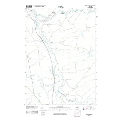
2010 Map of Port Leyden
USGS Topo · Published 2010About this map
Port Leyden and Lyons Falls serve as the primary anchors for this northern New York landscape, where the Black River and Moose River converge. The topography is defined by the steady descent of these waterways, which historically powered local industry at sites like Goulds Mill. Small hamlets and former post village sites such as Talcottville, Lyonsdale, and Shuetown are connected by a web of local routes including Penney Settlement Rd and Fowlerville Rd. Genealogy researchers will find several burial grounds of note, including Wildwood Cemetery, Calvary Cemetery, and the Leyden Hill Cemetery near Locust Grove. The map also details the winding paths of numerous tributaries like Beauty Creek, Fall Brook, and Sugar River, illustrating the well-watered character of the Tug Hill region foothills.
Find a feature on this map
67 named features on this map. Tap any name to fly to it.
Don’t see what you’re looking for? This feature index may not catch every label — zoom into the map to look around manually.
Map Details
Editions of this 2010 Port Leyden Map
This is the sole edition of this map. No revisions or reprints were ever made.
Other maps of this area

1897 · Remsen
USGS Topo · 1:62,500

1900 · Remsen
USGS Topo · 1:62,500

1904 · Boonville
USGS Topo · 1:62,500

1905 · Port Leyden
USGS Topo · 1:62,500

1907 · Port Leyden
USGS Topo · 1:62,500

1912 · Mc Keever
USGS Topo · 1:62,500

1940 · Port Leyden
USGS Topo · 1:62,500

1945 · Boonville
USGS Topo · 1:24,000

1945 · Forestport
USGS Topo · 1:24,000
1946 · West Leyden
USGS Topo · 1:31,680