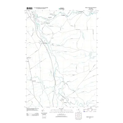
2013 Map of Port Leyden
USGS Topo · Published 2013About this map
The Black River carves a central path through this Lewis and Oneida County landscape, serving as the historical spine for settlements like Port Leyden and Goulds Mill. In the northern reaches, the Moose River winds through Lyonsdale and Fowlersville as it enters the Adirondack Park Preserve. The proximity of these two major rivers fostered a cluster of water-dependent hamlets, including Kosterville and Shuetown, where the local terrain transitions toward the wilderness.
Find a feature on this map
103 named features on this map. Tap any name to fly to it.
Don’t see what you’re looking for? This feature index may not catch every label — zoom into the map to look around manually.
Map Details
Editions of this 2013 Port Leyden Map
This is the sole edition of this map. No revisions or reprints were ever made.
Other maps of this area

1897 · Remsen
USGS Topo · 1:62,500

1900 · Remsen
USGS Topo · 1:62,500

1904 · Boonville
USGS Topo · 1:62,500

1905 · Port Leyden
USGS Topo · 1:62,500

1907 · Port Leyden
USGS Topo · 1:62,500

1912 · Mc Keever
USGS Topo · 1:62,500

1940 · Port Leyden
USGS Topo · 1:62,500

1945 · Boonville
USGS Topo · 1:24,000

1945 · Forestport
USGS Topo · 1:24,000
1946 · West Leyden
USGS Topo · 1:31,680