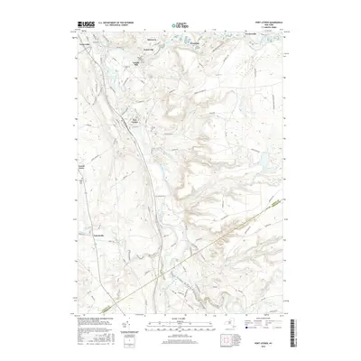
2016 Map of Port Leyden
USGS Topo · Published 2016About this map
Port Leyden and Lyons Falls anchor this landscape where the Black River meets its major tributaries at the edge of the Adirondack Park Preserve. The topography reveals a history of water-powered industry and river-side settlement, evident in the cluster of small communities including Goulds Mill, Kosterville, and Lyonsdale. Genealogists can locate several local burial grounds such as Wildwood Cem, Calvary Cem, and Leyden Hill Cem. The southern reach of the map shows the transition into Oneida Co near Talcottville, where the Sugar River flows through. A dense network of rural roads like Fowlersville Rd and Penney Settlement Rd connects these scattered hamlets, tracing the path of 19th-century growth through this river valley corridor.
Find a feature on this map
88 named features on this map. Tap any name to fly to it.
Don’t see what you’re looking for? This feature index may not catch every label — zoom into the map to look around manually.
Map Details
Editions of this 2016 Port Leyden Map
This is the sole edition of this map. No revisions or reprints were ever made.
Other maps of this area

1897 · Remsen
USGS Topo · 1:62,500

1900 · Remsen
USGS Topo · 1:62,500

1904 · Boonville
USGS Topo · 1:62,500

1905 · Port Leyden
USGS Topo · 1:62,500

1907 · Port Leyden
USGS Topo · 1:62,500

1912 · Mc Keever
USGS Topo · 1:62,500

1940 · Port Leyden
USGS Topo · 1:62,500

1945 · Boonville
USGS Topo · 1:24,000

1945 · Forestport
USGS Topo · 1:24,000
1946 · West Leyden
USGS Topo · 1:31,680