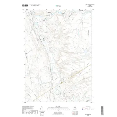
2019 Map of Port Leyden
USGS Topo · Published 2019About this map
The Black River and Moose River converge at the northern edge of this landscape, defining the industrial and geographic character of Lyons Falls and nearby Kosterville. Moving south, the terrain transitions into the high country where the Adirondack Park Preserve borders the eastern edge of the quadrangle. Local history is anchored by settlements such as Port Leyden and Talcottville, with family and community heritage evidenced by Leyden Hill Cem, Wildwood Cem, and Calvary Cem.
Find a feature on this map
88 named features on this map. Tap any name to fly to it.
Don’t see what you’re looking for? This feature index may not catch every label — zoom into the map to look around manually.
Map Details
Editions of this 2019 Port Leyden Map
This is the sole edition of this map. No revisions or reprints were ever made.
Other maps of this area

1897 · Remsen
USGS Topo · 1:62,500

1900 · Remsen
USGS Topo · 1:62,500

1904 · Boonville
USGS Topo · 1:62,500

1905 · Port Leyden
USGS Topo · 1:62,500

1907 · Port Leyden
USGS Topo · 1:62,500

1912 · Mc Keever
USGS Topo · 1:62,500

1940 · Port Leyden
USGS Topo · 1:62,500

1945 · Boonville
USGS Topo · 1:24,000

1945 · Forestport
USGS Topo · 1:24,000
1946 · West Leyden
USGS Topo · 1:31,680