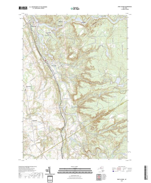
2023 Map of Port Leyden
USGS Topo · Published 2023About this map
The Black River and Moose River converge at Lyons Falls, anchoring a landscape defined by its river-driven geography. This 2023 survey documents the enduring settlement patterns of southern Lewis County, where the village of Port Leyden and smaller hamlets like Talcottville and Locust Grove follow the established transport corridors. The rugged terrain to the east transitions into the Adirondack Park Preserve, while the western portion is dotted with localized family and community landmarks such as Wildwood Cem and Leyden Hill Cem.
Find a feature on this map
99 named features on this map. Tap any name to fly to it.
Don’t see what you’re looking for? This feature index may not catch every label — zoom into the map to look around manually.
Map Details
Editions of this 2023 Port Leyden Map
This is the sole edition of this map. No revisions or reprints were ever made.
Other maps of this area

1897 · Remsen
USGS Topo · 1:62,500

1900 · Remsen
USGS Topo · 1:62,500

1904 · Boonville
USGS Topo · 1:62,500

1905 · Port Leyden
USGS Topo · 1:62,500

1907 · Port Leyden
USGS Topo · 1:62,500

1912 · Mc Keever
USGS Topo · 1:62,500

1940 · Port Leyden
USGS Topo · 1:62,500

1945 · Boonville
USGS Topo · 1:24,000

1945 · Forestport
USGS Topo · 1:24,000
1946 · West Leyden
USGS Topo · 1:31,680