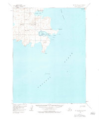
1963 Map of Port Moller A-2
USGS Topo · Published 1984About this map
Unga Island and its smaller neighbor Popof Island dominate this coastal survey of the Shumagin Islands. The small settlement of Unga sits at the head of Delarof Harbor, a sheltered anchorage protected by Flagstaff Hill. This area represents a significant intersection of early 20th-century industry and maritime trade, evidenced by the presence of the Apollo Mine situated on the slopes of Apollo Mountain. To the north, the village of Squaw Harbor looks out over Baralof Bay, while the treacherous waters of the Popof Strait separate the two primary landmasses. The coastline is punctuated by navigational landmarks like Kelly Rock, Elephant Rock, and Sealion Rocks, reflecting the importance of safe passage through these North Pacific waters for the fishing and mining operations that sustained these remote communities.
Find a feature on this map
20 named features on this map. Tap any name to fly to it.
Don’t see what you’re looking for? This feature index may not catch every label — zoom into the map to look around manually.
Map Details
Editions of this 1963 Port Moller A-2 Map
3 editions found
Other maps of this area

1953 · Port Moller
USGS Topo · 1:250,000

1963 · Port Moller A-1
USGS Topo · 1:63,360

1963 · Port Moller A-2
USGS Topo · 1:63,360

1963 · Port Moller B-2
USGS Topo · 1:63,360

1963 · Port Moller B-1
USGS Topo · 1:63,360
1963 · Simeonof Island D-4
USGS Topo · 1:63,360
1963 · Port Moller A-3
USGS Topo · 1:63,360

1963 · Simeonof Island
USGS Topo · 1:250,000

1967 · Simeonof Island
USGS Topo · 1:250,000

1983 · Port Moller B-3
USGS Topo · 1:63,360