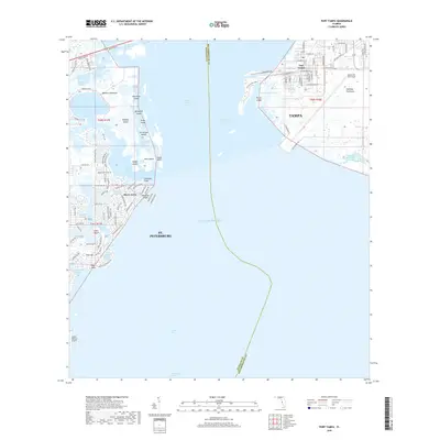
2018 Map of Port Tampa
USGS Topo · Published 2018About this map
Port Tampa and the Interbay Peninsula stand at the heart of this maritime landscape, where the waters of Old Tampa Bay meet the Gulf of Mexico. The map documents a heavily developed coastal environment, dominated by the strategic footprint of MacDill Air Force Base to the east and the residential waterfronts of St. Petersburg to the west. Between these urban centers lies a complex system of islands and inlets, including Weedon Island and Benjamin Island, which are separated from the mainland by Masters Bayou.
Find a feature on this map
113 named features on this map. Tap any name to fly to it.
Don’t see what you’re looking for? This feature index may not catch every label — zoom into the map to look around manually.
Map Details
Editions of this 2018 Port Tampa Map
This is the sole edition of this map. No revisions or reprints were ever made.
Other maps of this area

1921 · Tampa
USGS Topo · 1:62,500

1921 · Fort De Soto
USGS Topo · 1:62,500

1921 · St Petersburg
USGS Topo · 1:62,500

1942 · Cockroach Bay
USGS Topo · 1:31,680

1943 · St Petersburg
USGS Topo · 1:31,680

1943 · Gandy Bridge
USGS Topo · 1:31,680

1943 · Pass-A-Grille
USGS Topo · 1:31,680

1943 · Safety Harbor
USGS Topo · 1:31,680

1943 · Port Tampa
USGS Topo · 1:31,680

1944 · Ruskin
USGS Topo · 1:31,680