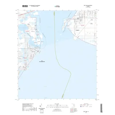
2021 Map of Port Tampa
USGS Topo · Published 2021About this map
Tampa and St. Petersburg face one another across the expansive waters of Old Tampa Bay in this contemporary topographical view. The map highlights the intense coastal development and maritime infrastructure that defines the region, from the residential grids of Shore Acres to the strategic positioning of MacDill Air Force Base on the Interbay Peninsula. The boundary between Pinellas and Hillsborough counties cuts directly through the open water, illustrating the administrative divide in this shared harbor. On the western shore, the Albert Whitted Airport stands as a prominent landmark on the St. Petersburg waterfront, while Port Tampa occupies the eastern peninsula, anchoring the industrial and transport networks of the bay. The map provides a clear look at the complex shoreline, where urban expansion meets the intricate inlets and channels of the Florida coast.
Find a feature on this map
10 named features on this map. Tap any name to fly to it.
Don’t see what you’re looking for? This feature index may not catch every label — zoom into the map to look around manually.
Map Details
Editions of this 2021 Port Tampa Map
This is the sole edition of this map. No revisions or reprints were ever made.
Other maps of this area

1921 · Tampa
USGS Topo · 1:62,500

1921 · Fort De Soto
USGS Topo · 1:62,500

1921 · St Petersburg
USGS Topo · 1:62,500

1942 · Cockroach Bay
USGS Topo · 1:31,680

1943 · St Petersburg
USGS Topo · 1:31,680

1943 · Gandy Bridge
USGS Topo · 1:31,680

1943 · Pass-A-Grille
USGS Topo · 1:31,680

1943 · Safety Harbor
USGS Topo · 1:31,680

1943 · Port Tampa
USGS Topo · 1:31,680

1944 · Ruskin
USGS Topo · 1:31,680