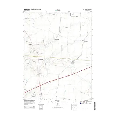
2013 Map of Port William
USGS Topo · Published 2013About this map
Port William serves as a focal point in this agricultural landscape along the Anderson Fork, where the boundary between Greene and Clinton counties divides the terrain. The area is characterized by a high concentration of small family and community burial grounds, including the Mitchell, Salem, and New Hope cemeteries, which offer significant value for genealogical research in this part of Ohio. Smaller settlements like Paintersville, Lumberton, and Gunnerville are connected by a network of rural roads such as Waynesville Jamestown Rd and Hussey Rd. Aviation history is visible through several local landing strips, including Lyons Field and Clinton Field Airport, indicating the area's continued reliance on private aviation. The drainage patterns of Painters Run, Grog Run, and Dutch Creek define the local topography, illustrating the traditional creek-side settlement patterns of the region.
Find a feature on this map
81 named features on this map. Tap any name to fly to it.
Don’t see what you’re looking for? This feature index may not catch every label — zoom into the map to look around manually.
Map Details
Editions of this 2013 Port William Map
This is the sole edition of this map. No revisions or reprints were ever made.
Other maps of this area

1907 · Blanchester
USGS Topo · 1:62,500

1916 · Octa
USGS Topo · 1:62,500

1917 · Xenia
USGS Topo · 1:62,500

1917 · Sabina
USGS Topo · 1:62,500

1943 · Sabina
USGS Topo · 1:62,500

1944 · Octa
USGS Topo · 1:62,500

1947 · Columbus
USGS Topo · 1:250,000

1955 · New Burlington
USGS Topo · 1:24,000

1955 · Cedarville
USGS Topo · 1:24,000

1955 · Port William
USGS Topo · 1:24,000