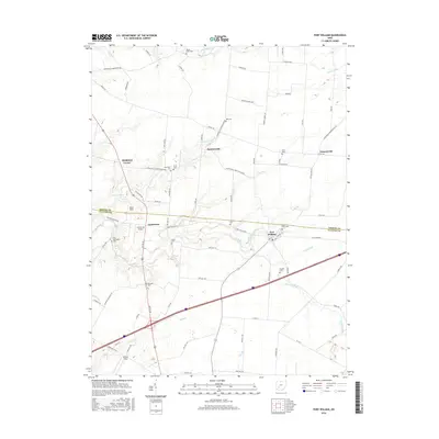
2016 Map of Port William
USGS Topo · Published 2016About this map
Port William serves as the central hub of this agricultural landscape in the mid-2010s, situated where the Anderson Fork winds through the borderlands of Greene and Clinton counties. The map captures a well-established network of farm roads and small settlements like Paintersville and Lumberton, reflecting the deep-rooted rural character of Liberty Township. Numerous family and community burial grounds, including Maple Grove Cem, Mount Tabor Cem, and Bab Cem, are scattered across the terrain, offering significant value for genealogical research. Aviation interests are represented by local strips such as Lumberton Airport and Clinton Field, while the hydrology is dominated by the branches of S Br Caesar Cr and several named runs like Painters Run and Grog Run that drain the fertile Ohio farmland.
Find a feature on this map
83 named features on this map. Tap any name to fly to it.
Don’t see what you’re looking for? This feature index may not catch every label — zoom into the map to look around manually.
Map Details
Editions of this 2016 Port William Map
This is the sole edition of this map. No revisions or reprints were ever made.
Other maps of this area

1907 · Blanchester
USGS Topo · 1:62,500

1916 · Octa
USGS Topo · 1:62,500

1917 · Xenia
USGS Topo · 1:62,500

1917 · Sabina
USGS Topo · 1:62,500

1943 · Sabina
USGS Topo · 1:62,500

1944 · Octa
USGS Topo · 1:62,500

1947 · Columbus
USGS Topo · 1:250,000

1955 · New Burlington
USGS Topo · 1:24,000

1955 · Cedarville
USGS Topo · 1:24,000

1955 · Port William
USGS Topo · 1:24,000