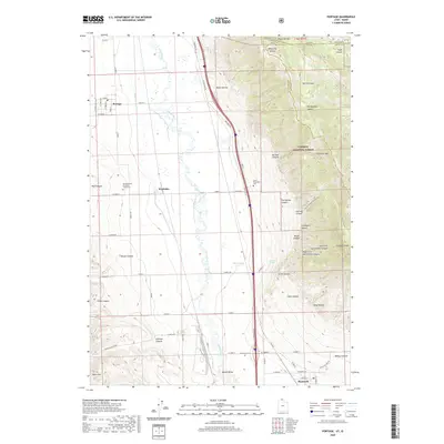
2020 Map of Portage
USGS Topo · Published 2020About this map
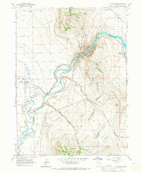
The Malad Valley floor transitions into the high ridges of the Caribou National Forest in this 2020 topographic record. The valley floor is defined by the meandering Malad River and the engineered irrigation of the Samaria Lake Canal, supporting the agricultural settlements of Portage, Washakie, and Plymouth. For genealogists and local historians, the map identifies specific sacred and burial sites including the Northwestern Shoshoni Tribal Cem near Washakie and the Early Plymouth Cem tucked against the hills. To the east, the landscape rises dramatically toward Clarkston Mtn and Gunsight Peak, carved by numerous drainages such as Castlegate Canyon and Old Quigley Canyon. This modern survey documents the contemporary interface between established Mormon corridor communities and the preserved wilderness along the Box Elder and Cache County line.
Find a feature on this map
59 named features on this map. Tap any name to fly to it.
Don’t see what you’re looking for? This feature index may not catch every label — zoom into the map to look around manually.
Map Details
Editions of this 2020 Portage Map
This is the sole edition of this map. No revisions or reprints were ever made.
Other maps of this area

1954 · Pocatello
USGS Topo · 1:250,000

1954 · Brigham City
USGS Topo · 1:250,000

1958 · Pocatello
USGS Topo · 1:250,000

1958 · Brigham City
USGS Topo · 1:250,000

1962 · Brigham City
USGS Topo · 1:250,000
1964 · Riverside
USGS Topo · 1:24,000
1964 · Clarkston
USGS Topo · 1:24,000
1964 · Portage
USGS Topo · 1:24,000
1964 · Cutler Dam
USGS Topo · 1:24,000

1968 · Samaria
USGS Topo · 1:24,000