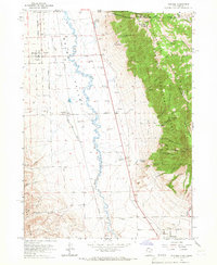
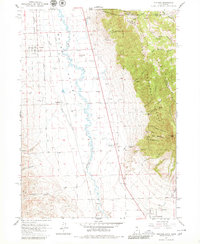
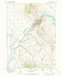
1964 Map of Portage
USGS Topo · Published 1966About this map
The Malad Valley floor and the steep western slopes of Clarkston Mountain define this mid-1960s landscape along the Idaho-Utah border. The Malad River meanders through the valley, flanked by the Union Pacific rail line and the agricultural lifelines of the Samaria Lake Canal. This survey records the layout of Portage and Washakie during a period of established rural settlement, showing the precise locations of the Washakie Cem and Plymouth Cem. Further south, the town of Plymouth sits near the base of the mountains where the terrain transitions from irrigated flats to the high, timbered draws of the Cache National Forest. Numerous canyons, such as Elgrove Canyon and Castlegate Canyon, cut into the mountain face, providing a detailed view of the water sources that sustained these border communities, including Mound Spring and Oregon Springs.
Find a feature on this map
46 named features on this map. Tap any name to fly to it.
Don’t see what you’re looking for? This feature index may not catch every label — zoom into the map to look around manually.
Map Details
Editions of this 1964 Portage Map
2 editions found
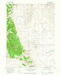
Other maps of this area

1954 · Pocatello
USGS Topo · 1:250,000

1954 · Brigham City
USGS Topo · 1:250,000

1958 · Pocatello
USGS Topo · 1:250,000

1958 · Brigham City
USGS Topo · 1:250,000

1962 · Brigham City
USGS Topo · 1:250,000
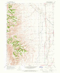
1964 · Riverside
USGS Topo · 1:24,000
1964 · Clarkston
USGS Topo · 1:24,000
1964 · Cutler Dam
USGS Topo · 1:24,000
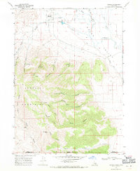
1968 · Samaria
USGS Topo · 1:24,000
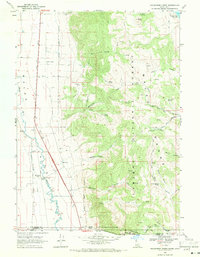
1968 · Henderson Creek
USGS Topo · 1:24,000