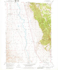
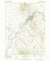
1964 Map of Portage
USGS Topo · Published 1980About this map
The Malad Valley corridor straddles the Utah-Idaho border, where agriculture and early transit routes converged in the mid-1960s. The Union Pacific railroad runs parallel to the Malad River, supporting a series of small agricultural settlements along the valley floor. Portage and Washakie serve as primary points of interest, with the latter featuring the Washakie Cem and local irrigation works like the Samaria Lake Canal. This landscape transitions abruptly from the flat, spring-fed valley floor at Oregon Springs to the steep slopes of the Clarkston Mountains to the east. Within the Cache National Forest, numerous deep drainages such as Elgrove Canyon and Castlegate Canyon cut through the terrain, leading toward high points like Gunsight Peak. The presence of Mound Spring and several gravel pits underscores the area's reliance on its geological and water resources.
Find a feature on this map
43 named features on this map. Tap any name to fly to it.
Don’t see what you’re looking for? This feature index may not catch every label — zoom into the map to look around manually.
Map Details
Editions of this 1964 Portage Map
2 editions found
Other maps of this area

1954 · Pocatello
USGS Topo · 1:250,000

1954 · Brigham City
USGS Topo · 1:250,000

1958 · Pocatello
USGS Topo · 1:250,000

1958 · Brigham City
USGS Topo · 1:250,000

1962 · Brigham City
USGS Topo · 1:250,000
1964 · Riverside
USGS Topo · 1:24,000
1964 · Clarkston
USGS Topo · 1:24,000
1964 · Portage
USGS Topo · 1:24,000
1964 · Cutler Dam
USGS Topo · 1:24,000

1968 · Samaria
USGS Topo · 1:24,000