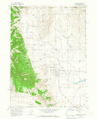
1964 Map of Clarkston
USGS Topo · Published 1966About this map
Clarkston serves as the primary hub of this northern Cache Valley landscape in the mid-1960s, situated at the base of a heavily canyoned mountain range. To the east, the terrain levels out into agricultural fields and the headwaters of the Newton Res, while the western edge is defined by the steep slopes of the Cache National Forest. The map reveals a complex drainage system where numerous canyons, such as Stuart Canyon and Raglanite Canyon, empty toward the valley floor, feeding into Clarkston Creek.
Find a feature on this map
57 named features on this map. Tap any name to fly to it.
Don’t see what you’re looking for? This feature index may not catch every label — zoom into the map to look around manually.
Map Details
Editions of this 1964 Clarkston Map
2 editions found
Other maps of this area

1914 · Logan
USGS Topo · 1:125,000

1915 · Preston
USGS Topo · 1:96,000

1916 · Logan
USGS Topo · 1:125,000

1918 · Preston
USGS Topo · 1:125,000

1954 · Pocatello
USGS Topo · 1:250,000

1954 · Ogden
USGS Topo · 1:250,000

1954 · Brigham City
USGS Topo · 1:250,000

1955 · Preston
USGS Topo · 1:250,000

1958 · Ogden
USGS Topo · 1:250,000

1958 · Pocatello
USGS Topo · 1:250,000