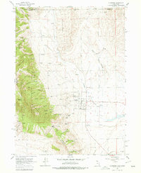
1964 Map of Clarkston
USGS Topo · Published 1978About this map
Clarkston sits as a clustered center of agriculture and irrigation at the base of the mountains along the Utah-Idaho border. The landscape is defined by the transition from the irrigated fields of Hammond Flat to the steep, wooded slopes of the Caribou National Forest. Water management is central to this high-desert settlement, with Birch Creek and Clarkston Creek providing vital flow to the valley below. The surrounding terrain is marked by numerous family-named landmarks and springs, such as Archibald Hollow, Bensons Hollow, and Kinnikinick Spring, illustrating the early ranching and homesteading history of Cache County. A Cem stands on the northern edge of the town site, while the higher elevations are crisscrossed by a Pack Trail and a Jeep Trail, hinting at the area's use for timber and grazing during the mid-twentieth century.
Find a feature on this map
51 named features on this map. Tap any name to fly to it.
Don’t see what you’re looking for? This feature index may not catch every label — zoom into the map to look around manually.
Map Details
Editions of this 1964 Clarkston Map
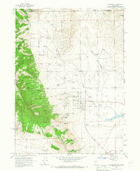
2 editions found
Other maps of this area

1914 · Logan
USGS Topo · 1:125,000

1915 · Preston
USGS Topo · 1:96,000

1916 · Logan
USGS Topo · 1:125,000

1918 · Preston
USGS Topo · 1:125,000

1954 · Pocatello
USGS Topo · 1:250,000

1954 · Ogden
USGS Topo · 1:250,000

1954 · Brigham City
USGS Topo · 1:250,000

1955 · Preston
USGS Topo · 1:250,000

1958 · Ogden
USGS Topo · 1:250,000

1958 · Pocatello
USGS Topo · 1:250,000