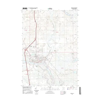
2016 Map of Portage
USGS Topo · Published 2016About this map
Portage occupies a singular geographic position where the Fox River and Wisconsin River nearly meet, a historic portage point reflected in the city’s name and street layout. This 2016 survey highlights the complex wetlands and waterways surrounding the city, including Swan Lake, Mud Lake, and the expansive Silver Lake with its Silver Lake Beach. The map details the local history through its many burial grounds, such as the Old Fort Winnebago Cem and Oak Grove Cem, which anchor the landscape's heritage. Transportation infrastructure is prominent, from the Soo Line railroad tracks to the Portage Municipal Airport and Coleman Airport. Hikers and conservationists can trace the winding route of the Ice Age National Scenic Trail as it passes through the city and skirts the riverbanks, while the presence of Westerberg Island and Duck Creek illustrates the intricate riparian environment of Columbia County.
Find a feature on this map
102 named features on this map. Tap any name to fly to it.
Don’t see what you’re looking for? This feature index may not catch every label — zoom into the map to look around manually.
Map Details
Editions of this 2016 Portage Map
This is the sole edition of this map. No revisions or reprints were ever made.
Other maps of this area

1895 · Baraboo
USGS Topo · 1:62,500

1901 · Poynette
USGS Topo · 1:62,500

1902 · Portage
USGS Topo · 1:62,500

1902 · Briggsville
USGS Topo · 1:62,500

1908 · Baraboo
USGS Topo · 1:62,500

1957 · Madison
USGS Topo · 1:250,000

1958 · Briggsville
USGS Topo · 1:62,500

1959 · Baraboo
USGS Topo · 1:62,500

1960 · Madison
USGS Topo · 1:250,000

1962 · Poynette
USGS Topo · 1:62,500