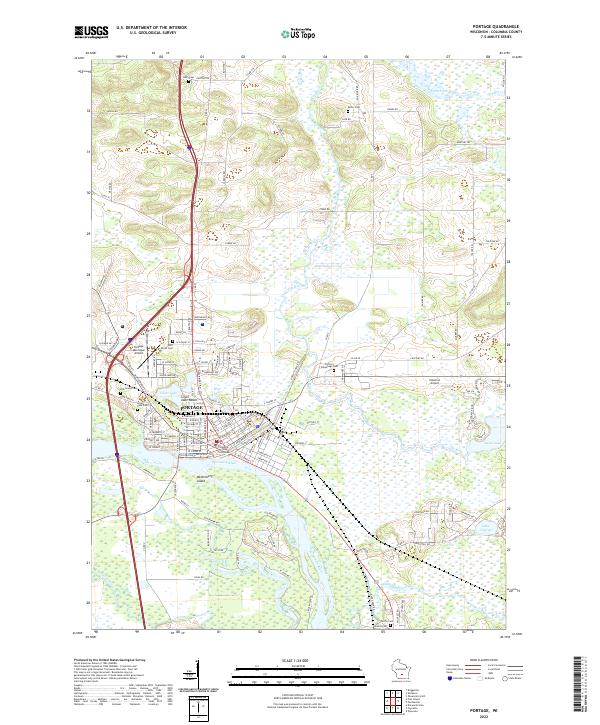
2022 Map of Portage
USGS Topo · Published 2022About this map
The Portage area is defined by the historic confluence of major waterways, where the Fox River and the Wisconsin River nearly meet. This geographical bottleneck, long a vital portage point for travel and trade, is anchored by the Columbia County Courthouse and a dense network of city streets including W Cook St and W Pleasant St. The map illustrates a landscape of wetlands and water bodies, including Silver Lake, Swan Lake, and the meandering French Creek.
Find a feature on this map
116 named features on this map. Tap any name to fly to it.
Don’t see what you’re looking for? This feature index may not catch every label — zoom into the map to look around manually.
Map Details
Editions of this 2022 Portage Map
This is the sole edition of this map. No revisions or reprints were ever made.
Other maps of this area

1895 · Baraboo
USGS Topo · 1:62,500

1901 · Poynette
USGS Topo · 1:62,500

1902 · Portage
USGS Topo · 1:62,500

1902 · Briggsville
USGS Topo · 1:62,500

1908 · Baraboo
USGS Topo · 1:62,500

1957 · Madison
USGS Topo · 1:250,000

1958 · Briggsville
USGS Topo · 1:62,500

1959 · Baraboo
USGS Topo · 1:62,500

1960 · Madison
USGS Topo · 1:250,000

1962 · Poynette
USGS Topo · 1:62,500