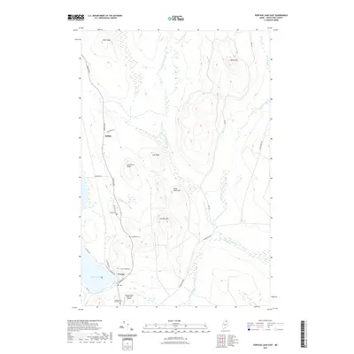
2021 Map of Portage Lake East
USGS Topo · Published 2021About this map
The town of Portage and the settlement of Buffalo anchor the western edge of this Aroostook County landscape, where the Fish River chain begins to give way to the forested uplands of northern Maine. This survey documents a transition from the water-oriented community around Portage Lake to the timber-rich ridges of the interior. Transportation is focused along Portage Rd, which connects the various family and local landmarks, while the Allen St Peter Memorial Airport serves as a vital remote link. Genealogists will find significance in the distribution of community burial grounds, including Buffalo Cem, Goodblood Cem, and the Portage Lake Catholic Cem. The terrain is defined by a series of prominent rises such as Moose Mtn, Three Burnt Mtn, and Lanigan Mtn, with a network of waterways like W Br Beaver Brook and E Br Beaver Brook carving through the ridgelines of Bear Ridge and Oak Ridge.
Find a feature on this map
29 named features on this map. Tap any name to fly to it.
Don’t see what you’re looking for? This feature index may not catch every label — zoom into the map to look around manually.
Map Details
Editions of this 2021 Portage Lake East Map
This is the sole edition of this map. No revisions or reprints were ever made.
Other maps of this area

1928 · Winterville
USGS Topo · 1:48,000

1929 · Portage
USGS Topo · 1:62,500

1930 · Greenlaw
USGS Topo · 1:48,000

1931 · Ashland
USGS Topo · 1:48,000

1931 · Portage
USGS Topo · 1:62,500

1931 · Winterville
USGS Topo · 1:62,500

1933 · Greenlaw
USGS Topo · 1:62,500

1934 · Ashland
USGS Topo · 1:62,500

1953 · Ashland
USGS Topo · 1:62,500

1953 · Portage
USGS Topo · 1:62,500