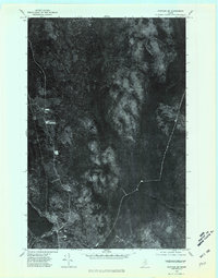
1975 Map of Portage SW
USGS Topo · Published 1981About this map
Portage serves as the focal point for this orthophotoquad, situated along the southeastern shore of Portage Lake. Unlike traditional topographic maps, this imagery-based survey captures the literal texture of the Maine timberlands during the mid-1970s. The settlement's footprint is clearly visible against the dense forest, showing the concentration of buildings and cleared land where local life meets the lakefront.
Find a feature on this map
8 named features on this map. Tap any name to fly to it.
Don’t see what you’re looking for? This feature index may not catch every label — zoom into the map to look around manually.
Map Details
Editions of this 1975 Portage SW Map
This is the sole edition of this map. No revisions or reprints were ever made.
Other maps of this area

1928 · Winterville
USGS Topo · 1:48,000

1929 · Portage
USGS Topo · 1:62,500

1930 · Greenlaw
USGS Topo · 1:48,000

1931 · Ashland
USGS Topo · 1:48,000

1931 · Portage
USGS Topo · 1:62,500

1931 · Winterville
USGS Topo · 1:62,500

1933 · Greenlaw
USGS Topo · 1:62,500

1934 · Ashland
USGS Topo · 1:62,500

1953 · Ashland
USGS Topo · 1:62,500

1953 · Portage
USGS Topo · 1:62,500