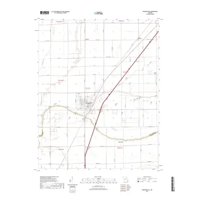
2017 Map of Portageville
USGS Topo · Published 2017About this map
Portageville stands as the primary hub in this corner of the Missouri Bootheel, situated at the intersection of local routes and the modern Interstate 55 corridor. The landscape is defined by the flat, fertile alluvial plains typical of the region, where the Little River meanders to the west and the Portage Open Bay cuts across the southern portion of the sheet. This area shows a dense concentration of rural family and community history, evidenced by the numerous cemeteries including Branham Cem, Crabtree Cem, and Kimes Cem that dot the outskirts of town and the surrounding fields.
Find a feature on this map
91 named features on this map. Tap any name to fly to it.
Don’t see what you’re looking for? This feature index may not catch every label — zoom into the map to look around manually.
Map Details
Editions of this 2017 Portageville Map
This is the sole edition of this map. No revisions or reprints were ever made.
Other maps of this area

1939 · Portageville
USGS Topo · 1:62,500

1939 · New Madrid
USGS Topo · 1:62,500

1940 · Malden
USGS Topo · 1:62,500

1940 · Pascola
USGS Topo · 1:62,500

1951 · New Madrid SE
USGS Topo · 1:24,000

1954 · New Madrid
USGS Topo · 1:62,500

1955 · Pascola
USGS Topo · 1:62,500

1955 · Portageville
USGS Topo · 1:62,500

1956 · Malden
USGS Topo · 1:62,500

1956 · Dyersburg
USGS Topo · 1:250,000