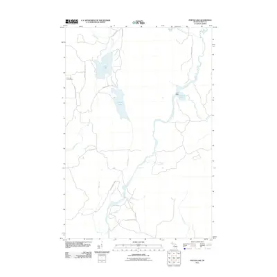
2011 Map of Porter Lake
USGS Topo · Published 2011About this map
The Net River winds through this section of Iron County, defining a landscape of northern wetlands and interconnected waterways. The river widens significantly at The Wide Waters and flows past landmarks such as Hotel Point and the cascades of Chipmunk Falls. This hydrological network is complemented by Cable Lake and Porter Lake, which are central to the area's geography. Historically, the presence of the Perch Lake Lookout Tower suggests the long-term importance of fire observation in this heavily forested region of Michigan's Upper Peninsula.
Find a feature on this map
25 named features on this map. Tap any name to fly to it.
Don’t see what you’re looking for? This feature index may not catch every label — zoom into the map to look around manually.
Map Details
Editions of this 2011 Porter Lake Map
This is the sole edition of this map. No revisions or reprints were ever made.
Other maps of this area

1895 · Ned Lake
USGS Topo · 1:62,500

1895 · Perch Lake
USGS Topo · 1:62,500

1898 · Iron River
USGS Topo · 1:62,500

1899 · Crystal Falls
USGS Topo · 1:62,500

1945 · Gibbs City
USGS Topo · 1:24,000

1945 · Sunset Lake
USGS Topo · 1:24,000

1945 · Amasa
USGS Topo · 1:24,000

1946 · Sunset Lake
USGS Topo · 1:31,680

1946 · Gibbs City
USGS Topo · 1:31,680
1947 · Amasa
USGS Topo · 1:24,000