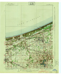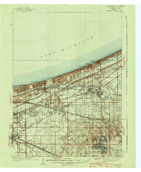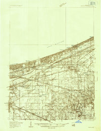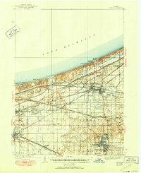
1940 Map of Porter
USGS Topo · Published 1950About this map
Lake Michigan dominates the northern horizon of this mid-century Indiana landscape, where the shifting sands of Indiana Dunes State Park meet a complex network of industrial and commuter rail lines. The interior reveals a region in transition, centered on the growing hubs of Chesterton and Porter. To the west, East Gary and Hobart anchor a more developed corridor, while the southeast remains punctuated by clusters of glacial lakes like Flint Lake and Wahob Lake. The mapping of landmarks such as the Seven Dolors Shrine and Tratabas Mill alongside the numerous rail systems—including the Chicago South Bend and Northern Indiana—illustrates the dual character of the Calumet region as both a recreational retreat and a vital transportation artery. Rural life persists at Cooks Corner Sch and along the winding banks of Salt Creek, even as the lakefront communities of Ogden Dunes and Dune Acres define the coastline.
Find a feature on this map
102 named features on this map. Tap any name to fly to it.
Don’t see what you’re looking for? This feature index may not catch every label — zoom into the map to look around manually.
Map Details
Editions of this 1940 Porter Map
3 editions found