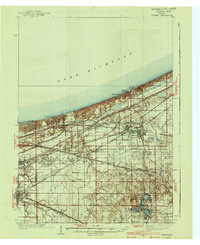
1940 Map of Porter
USGS Topo · Published 1940About this map
Indiana Dunes State Park dominates the northern shoreline in this survey, showcasing the complex topography of the lakeshore before mid-century industrial expansion. The map details a dense corridor of rail infrastructure, where the Chicago South Shore and South Bend RR and New York Central RR parallel the coast, serving established towns like Chesterton and Porter. Further inland, the landscape transitions into the smaller rural hubs of Liberty and Union townships.
Find a feature on this map
74 named features on this map. Tap any name to fly to it.
Don’t see what you’re looking for? This feature index may not catch every label — zoom into the map to look around manually.
Map Details
Editions of this 1940 Porter Map
3 editions found
Other maps of this area

1900 · Toleston
USGS Topo · 1:62,500

1934 · Porter
USGS Topo · 1:48,000

1940 · Porter
USGS Topo · 1:62,500

1953 · Palmer
USGS Topo · 1:24,000

1953 · Gary
USGS Topo · 1:24,000

1953 · Crown Point
USGS Topo · 1:24,000

1953 · Wanatah
USGS Topo · 1:24,000

1953 · Garyton
USGS Topo · 1:24,000

1953 · Westville
USGS Topo · 1:24,000

1953 · Valparaiso
USGS Topo · 1:24,000