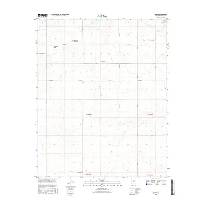
2017 Map of Porter
USGS Topo · Published 2017About this map
Porter and the northern edge of San Jon anchor this high plains landscape in eastern New Mexico. The area is defined by a rigid section-line grid of rural corridors, including Quay Road P, Quay Road T, and Quay Road 65, which traverse the open range of Quay County. This geometric road network reveals the enduring influence of the Public Land Survey System on local ranching and transit patterns, even as the terrain breaks into the drainage of Tuscocillo Canyon in the northwest. While the settlements themselves are modest, the map provides a clear view of the cadastral divisions and topographic contours that have shaped land use in this part of the Llano Estacado for over a century.
Find a feature on this map
25 named features on this map. Tap any name to fly to it.
Don’t see what you’re looking for? This feature index may not catch every label — zoom into the map to look around manually.
Map Details
Editions of this 2017 Porter Map
This is the sole edition of this map. No revisions or reprints were ever made.
Other maps of this area

1954 · Tucumcari
USGS Topo · 1:250,000

1958 · Tucumcari
USGS Topo · 1:250,000

1962 · Logan
USGS Topo · 1:62,500

1968 · Porter
USGS Topo · 1:24,000

1968 · Blue Hole
USGS Topo · 1:24,000

1968 · Riley Camp
USGS Topo · 1:24,000

1968 · San Jon
USGS Topo · 1:24,000

1968 · Bard
USGS Topo · 1:24,000

1968 · San Jon NW
USGS Topo · 1:24,000

1968 · Bedford Hill
USGS Topo · 1:24,000