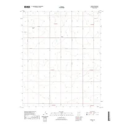
2020 Map of Porter
USGS Topo · Published 2020About this map
Porter sits at the center of this eastern New Mexico landscape, serving as a focal point for the surrounding ranchlands and high plains. The terrain is defined by the dramatic descent into Tuscocollo Canyon, which cuts through the northern sections of the township. This 2020 survey illustrates a region shaped by a rigorous grid of section lines and gravel paths, where the systematic organization of the land is evident in the naming of thoroughfares like Quay Road 67 and Quay Road 65. The map provides a clear view of the rural infrastructure in Quay County, documenting the specific locations of homesteads and the intermittent drainage patterns that characterize the local geography. It is an essential document for understanding the modern distribution of land and the persistent layout of this cattle-country settlement.
Find a feature on this map
16 named features on this map. Tap any name to fly to it.
Don’t see what you’re looking for? This feature index may not catch every label — zoom into the map to look around manually.
Map Details
Editions of this 2020 Porter Map
This is the sole edition of this map. No revisions or reprints were ever made.
Other maps of this area

1954 · Tucumcari
USGS Topo · 1:250,000

1958 · Tucumcari
USGS Topo · 1:250,000

1962 · Logan
USGS Topo · 1:62,500

1968 · Porter
USGS Topo · 1:24,000

1968 · Blue Hole
USGS Topo · 1:24,000

1968 · Riley Camp
USGS Topo · 1:24,000

1968 · San Jon
USGS Topo · 1:24,000

1968 · Bard
USGS Topo · 1:24,000

1968 · San Jon NW
USGS Topo · 1:24,000

1968 · Bedford Hill
USGS Topo · 1:24,000