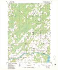
1982 Map of Porterfield
USGS Topo · Published 1983About this map
The Peshtigo River meanders across the southern landscape of this Marinette County region, serving as a primary geographic anchor for the townships of Grover and Peshtigo. In the early 1980s, the area remained a blend of rural agriculture and industry, defined by a dense network of gravel pits and quarries that dot the terrain between the river and the northern reaches of Wagner. The Chicago Milwaukee St Paul and Pacific rail line provides a transit corridor through the heart of the map, passing by the central community of Porterfield, where local life is centered around the Porterfield Ch and Porterfield Sch. Further east, the settlement of Walsh sits near St Joseph Cem, while the confluence of rail lines at Bagley Junction marks a key historical transportation node. Small waterways like Gravelly Brook and Twin Creek drain the swampy lowlands, reflecting the glacial character of this Wisconsin interior.
Find a feature on this map
55 named features on this map. Tap any name to fly to it.
Don’t see what you’re looking for? This feature index may not catch every label — zoom into the map to look around manually.
Map Details
Editions of this 1982 Porterfield Map
This is the sole edition of this map. No revisions or reprints were ever made.
Other maps of this area

1939 · Marinette
USGS Topo · 1:48,000

1939 · Porterfield
USGS Topo · 1:48,000

1942 · Porterfield
USGS Topo · 1:48,000

1942 · Wausaukee
USGS Topo · 1:48,000

1947 · Wausaukee
USGS Topo · 1:48,000

1949 · Stephenson
USGS Topo · 1:48,000

1954 · Escanaba
USGS Topo · 1:250,000

1957 · Escanaba
USGS Topo · 1:250,000

1958 · Escanaba
USGS Topo · 1:250,000

1963 · Porterfield
USGS Topo · 1:62,500