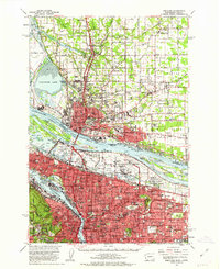
1961 Map of Portland
USGS Topo · Published 1963About this map
The Columbia River and Willamette River define this early 1960s view of the Pacific Northwest, where the growing urban cores of Portland and Vancouver are connected by the Pacific Highway. The landscape reveals a transition from industrial riverfronts, including the Shipyard and various Gravel Pits, to residential neighborhoods like Laurelhurst, Hollywood, and St. Johns. Aviation and military history are prominent, featuring the Portland International Airport, Portland Air Force Base, and Pearson Airport alongside the Fort Vancouver National Monument.
Find a feature on this map
202 named features on this map. Tap any name to fly to it.
Don’t see what you’re looking for? This feature index may not catch every label — zoom into the map to look around manually.
Map Details
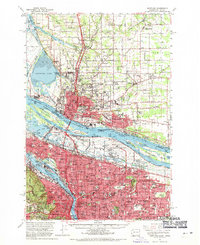
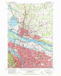
Editions of this 1961 Portland Map
3 editions found
Other maps of this area

1897 · Portland
USGS Topo · 1:62,500

1905 · Portland
USGS Topo · 1:62,500

1911 · Boring
USGS Topo · 1:48,000

1914 · Boring
USGS Topo · 1:62,500

1914 · Oregon City
USGS Topo · 1:62,500

1915 · Hillsboro
USGS Topo · 1:62,500

1916 · Tualatin
USGS Topo · 1:62,500

1916 · Estacada
USGS Topo · 1:125,000

1918 · Hillsboro
USGS Topo · 1:62,500

1918 · Troutdale
USGS Topo · 1:62,500