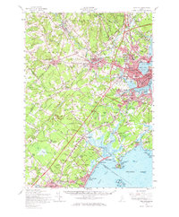
1916 Map of Portland
USGS Topo · Published 1929About this map
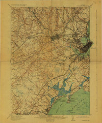
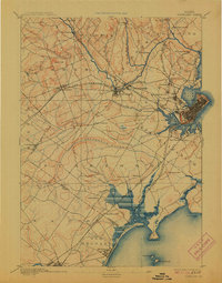
The coastal and inland landscape surrounding Portland reveals a complex network of early 20th-century industry and infrastructure. Centered on the tidal waters of Back Cove and the Fore River, the area is defined by its rail-oriented expansion. The Boston and Maine Railroad and the Worcester Nashua and Portland Division cross the terrain, connecting mill settlements like Cumberland Mills and Westbrook to the urban core. To the north, the Presumpscot River winds past Riverton Park, while the southern reaches towards Saco Bay show the transition to coastal geography at Prouts Neck and Higgins Beach. This survey records numerous neighborhood schools and institutions, including the State Reform School and several rural town farms. Beyond the growing urban grid, the landscape is punctuated by family-named landmarks like Scottow Hill and small rural meeting houses such as the Buggy Meetinghouse, providing a look at the social and economic fabric of the region before the arrival of modern interstate highways.
Find a feature on this map
127 named features on this map. Tap any name to fly to it.
Don’t see what you’re looking for? This feature index may not catch every label — zoom into the map to look around manually.
Map Details
Editions of this 1916 Portland Map
7 editions found


Historical Maps of Portland Through Time
11 maps found

1891 Portland
Cumberland County, ME
1893 Portland
Cumberland County, ME

1914 Portland
Cumberland County, ME
1916 Portland
Cumberland County, ME

1941 Portland
Cumberland County, ME
1949 Portland
Cumberland County, ME
1956 Portland
Cumberland County, ME
1957 Portland
Cumberland County, ME
1959 Portland
Cumberland County, ME
1963 Portland
Cumberland County, ME
1985 Portland
Cumberland County, ME