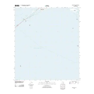
2010 Map of Portland
USGS Topo · Published 2010About this map
Portland sits at the junction of two major coastal water bodies, serving as the northern gateway across the Nueces Bay Causeway. This coastal landscape is defined by its maritime infrastructure and complex sub-aquatic geography. In the northern reaches of Corpus Christi Bay, a series of named hazards and landmarks guide navigation, including Indian Reef, Alta Vista Reef, and Donnel Reef. Near the shoreline, recreational and nautical interests are anchored at Gunderland Marina, while Indian Point and Sunset Lake frame the transition from open bay to the developed waterfront. Further east, La Quinta Island and the Cut A West Range Light indicate the heavy traffic and industrial requirements of these Texas coastal waters in the early 21st century.
Find a feature on this map
13 named features on this map. Tap any name to fly to it.
Don’t see what you’re looking for? This feature index may not catch every label — zoom into the map to look around manually.
Map Details
Editions of this 2010 Portland Map
This is the sole edition of this map. No revisions or reprints were ever made.
Other maps of this area

1925 · Aransas Pass
USGS Topo · 1:62,500

1925 · Oso Creek
USGS Topo · 1:62,500

1925 · Corpus Christi
USGS Topo · 1:62,500

1950 · Corpus Christi
USGS Topo · 1:250,000

1951 · Portland
USGS Topo · 1:24,000

1951 · Corpus Christi
USGS Topo · 1:24,000

1951 · Corpus Christi
USGS Topo · 1:62,500

1951 · Crane Islands NW
USGS Topo · 1:24,000

1951 · Oso Creek NW
USGS Topo · 1:24,000

1951 · Oso Creek NE
USGS Topo · 1:24,000