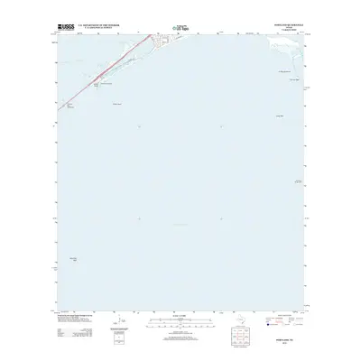
2013 Map of Portland
USGS Topo · Published 2013About this map
Nueces Bay Causeway spans the waters between Nueces Bay and Corpus Christi Bay, serving as a vital connection in this coastal landscape of shoals and reefs. The map emphasizes the maritime character of the area, featuring numerous submerged hazards such as Indian Reef, Alta Vista Reef, and Long Reef. On the northern shore, residential streets like 2nd St and Wildcat Dr define the edge of the community, while Sunset Lake provides a protected aquatic pocket behind Indian Point. The presence of the Gunderland Marina and the Cut A West Range Light underscores the region's reliance on bay navigation and recreational boating. Further east, La Quinta Island sits near Donnel Reef, marking the transition into more open bay waters where sandbars and shallow reefs dominate the local geography.
Find a feature on this map
17 named features on this map. Tap any name to fly to it.
Don’t see what you’re looking for? This feature index may not catch every label — zoom into the map to look around manually.
Map Details
Editions of this 2013 Portland Map
This is the sole edition of this map. No revisions or reprints were ever made.
Other maps of this area

1925 · Aransas Pass
USGS Topo · 1:62,500

1925 · Oso Creek
USGS Topo · 1:62,500

1925 · Corpus Christi
USGS Topo · 1:62,500

1950 · Corpus Christi
USGS Topo · 1:250,000

1951 · Portland
USGS Topo · 1:24,000

1951 · Corpus Christi
USGS Topo · 1:24,000

1951 · Corpus Christi
USGS Topo · 1:62,500

1951 · Crane Islands NW
USGS Topo · 1:24,000

1951 · Oso Creek NW
USGS Topo · 1:24,000

1951 · Oso Creek NE
USGS Topo · 1:24,000